
It’s Coming…
Hey, so, um… looks like snow is in the forecast.
We warned you yesterday to stock up on essentials. Now it’s time to hunker down.
Here’s what you need to know…
We have a BLIZZARD WARNING in effect from 1 p.m. Monday through 12 a.m. Wednesday. As opposed to a mere “WATCH,” where it might happen, “WARNING” means it’s coming.
Conditions:
-Heavy, blowing snow with accumulations up to 24 inches.
-Heavy winds at 20-30 mph, gusting up to 50+ mph
-Temperatures in the lower 20s
Concerns:
-Whiteout conditions with little to no visibility
-High winds could potentially damage power lines
-Heavy snowfall will make travel impossible
What to do:
-As little as possible
Dig in, get comfy and enjoy the ride.
SHOULD YOUR POWER GO OUT…
The City will set up a warming center at the Wallace School starting at 3 p.m.
Perspective:
Here’s why hMAG.com refuses to name winter storms…
While we’re all keenly aware of what bad weather can do to this town, there are significant differences between this and Sandy.
The National Weather Service has withdrawn its coastal flooding advisories. Furthermore, the moon is in a different phase, lessening the impact of high tide, so the threat of a storm surge is not present.
The issues we’re facing here are snow and wind, which—as formidable as they may be—are relatively short-term compared to flooding.
So as long as you’re not reckless enough to try any unnecessary travel, you should be ok when it’s all over.
Take this storm seriously, by sitting tight for the next 36 hours and letting nature take its course… then dig out.
See you on the other side…
 Previous Article
 Next Article
 Activities Suspended, State of Emergency Declared by City of Hoboken
 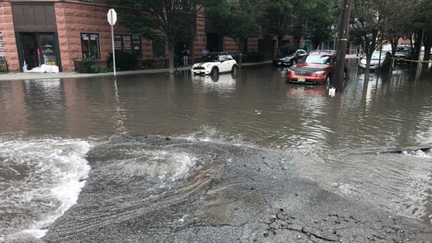 Major Hoboken Water Main Break Floods Southwestern Corner of Town
  HOBOKEN ON TAP: 902 Brewing Company to Open Tap Room
  IRISH EXIT: Hoboken LepreCon Pub Crawl Falls Flat
  Hoboken Water Main Break to Impact Residents “Through the Thanksgiving Holiday”
 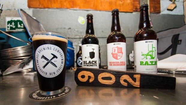 902 Brewing Anniversary Celebration at Finnegan’s — FRIDAY
  FEATURED PROPERTY: 227 Grand Street #1, Hoboken; Spacious, Stunning 3BR/2BA | $1,450,000
  ELYSIAN FIELDS ESCAPADE: Hoboken Historical Museum 30th Anniversary Gala — SATURDAY, MAY 14